
St. Cloud ZIP Code Directory Coverage
Postal coverage has a core St. Cloud set and a broader area or special-use set. The official Minnesota DVS county and ZIP listing gives “St Cloud, Stearns” as 56301 through 56304, 56372, and 56387 through 56399. A local area reference lists 56301 through 56304 as the core city set and includes nearby-area ZIPs as well. The table keeps the known source wording separate from assumptions about municipal boundaries.
| ZIP | Areas covered | Post office | Notes |
|---|---|---|---|
| 56301 | Core St. Cloud, with St. Augusta and Rockville alias overlap in USPS-derived data | St. Cloud postal area | Standard delivery; city boundary is not identical to ZIP |
| 56302 | Special or unique St. Cloud use in local listings | Not located in an official source | Verify by USPS address search; do not assume ordinary citywide delivery |
| 56303 | Core St. Cloud, especially north and central postal area | St. Cloud postal area | Standard city ZIP; confirm the exact address with USPS |
| 56304 | Core St. Cloud, south-east postal area | St. Cloud postal area | Standard city ZIP; city and ZIP lines may diverge |
| 56372 | Broader St. Cloud area or nearby postal coverage | Not located in an official source | Included in the DVS St Cloud list; verify neighborhood and post-office use |
| 56387 | Waite Park and greater St. Cloud postal area | Waite Park postal area | Nearby municipality, not automatically St. Cloud city |
| 56388 | Greater St. Cloud area, including nearby communities in area listings | Not located in an official source | Use USPS cities-by-ZIP for exact context |
| 56393 | Special or greater-area ZIP in the DVS reference | Not located in an official source | Exact post-office function was not located |
| 56395 | Special or greater-area ZIP in the DVS reference | Not located in an official source | USPS verification required |
| 56396 | Special or greater-area ZIP in the DVS reference | Not located in an official source | USPS verification required |
| 56397 | Special or greater-area ZIP in the DVS reference | Not located in an official source | USPS verification required |
| 56398 | Special or greater-area ZIP in the DVS reference | Not located in an official source | USPS verification required |
| 56399 | Special or greater-area ZIP in the DVS reference | Not located in an official source | USPS verification required |
Postal coverage is not the same as incorporated-city geography. The table identifies the documented St. Cloud label or area, not a claim that each listed ZIP serves all city addresses or that every special ZIP is a residential delivery area.
Core St. Cloud ZIPs
The practical starting point is 56301, 56303, or 56304 for a core St. Cloud address, then an exact-address USPS check. ZIP 56302 appears as a special or unique use in local lists, but its public delivery geography was not located. The source also places 56372 and 56387 through 56399 in the broader “St Cloud, Stearns” listing without providing a neighborhood or post-office breakdown for every one.
A ZIP result is a delivery standard, not proof that a person or organization is at an address. That distinction is central when checking a St. Cloud postal code. It also prevents a broader postal-area result from being mistaken for a city-limit line or a list of local residents.
USPS and the St. Cloud ZIP Code Directory
The USPS ZIP Lookup has three separate modes: address to ZIP, city and state to all ZIPs, and ZIP to cities. Use an exact street address, city, and state for the first route; city and state for the second; or one ZIP for cities-by-ZIP. USPS recommends a standardized street format and warns that its result does not confirm any person or business at the address.
| Address to ZIP | Street address, city, and state. Use it to verify delivery information for one address. |
|---|---|
| City and state | City and state. Use it to view ZIPs USPS associates with that locality label. |
| Cities by ZIP | ZIP only. Use it to check the city names associated with the postal code. |
The USPS lookup display is the documented postal reference for the three modes.
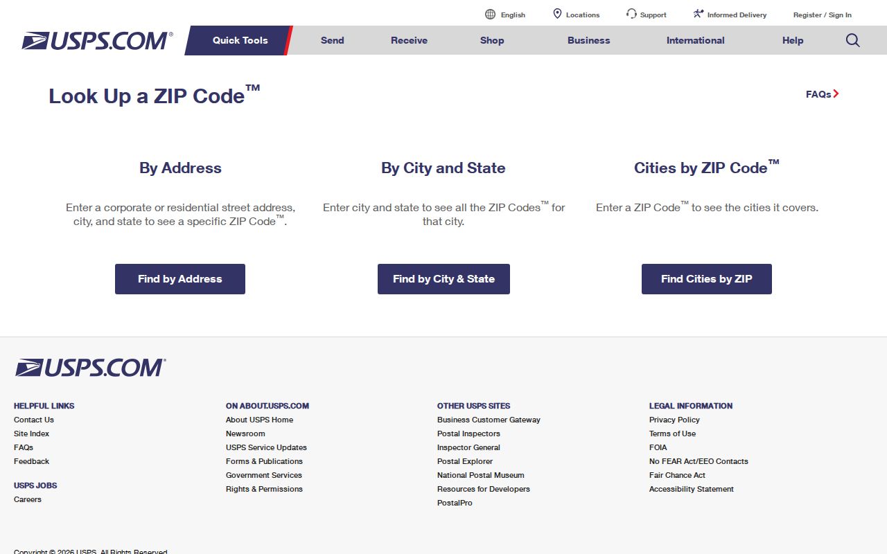
Use the USPS result before carrying a St. Cloud mailing ZIP into another record system. The result validates address formatting and postal context, while city and county records answer different questions.
Note: A city name shown by a postal tool can overlap nearby municipalities, so an exact address still needs a parcel or city check.
St. Cloud ZIP MNVotes Route
Minnesota MNVotes accepts a ZIP start or a county start for a person checking their own registration status. A ZIP does not create a ZIP-wide resident search. After the ZIP path begins, the form still requires first name, last name, birthday, city or township, house number, street, and an apartment or unit when relevant. The portal is updated nightly, and a new application can take up to 14 days to process before it appears the day after processing.
| Field | Required | St. Cloud ZIP path |
|---|---|---|
| First and last name | Yes | Enter the person’s name using the portal’s accepted characters. |
| Birthday | Yes | An exact date or year is used by the registration form. |
| Address search mode | Yes | Choose ZIP or county, then follow the selected path. |
| ZIP Code | Yes in ZIP path | Use the correct postal ZIP for the address. |
| City, house number, street, unit | Yes, with unit conditional | Choose the jurisdiction and standardized street; a unit becomes required when indicated. |
The MNVotes form documents the ZIP-start route and the required identity and address fields.
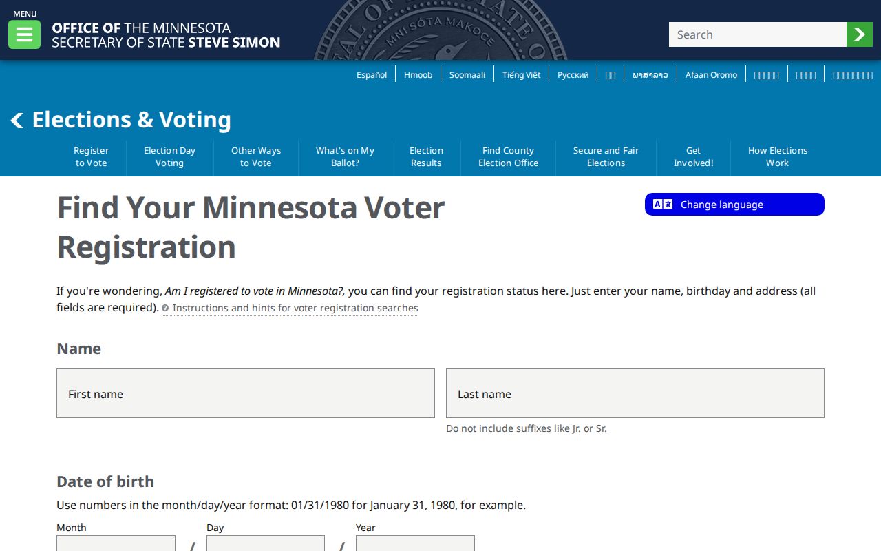
For public voter-information lists, Minnesota Stat. § 201.091 has a separate inspection or copy route with identity and written-use certification. It is not a shortcut for compiling a ZIP roster. Protected names and identifying numbers are withheld, and safety protections must be respected.
St. Cloud ZIP Property Checks
City and county property tools can test an address after its postal ZIP is confirmed, but the documented search modes are not ZIP-wide resident filters. The St. Cloud Property Search documents physical address, PIN without punctuation, STC Geocode, and ESRI World Geocoder. Select the suggested parcel and open its Single Feature report. This is a parcel and address route, not a substitute for USPS delivery verification.
The city property-search instructions show the documented address and parcel entry points.
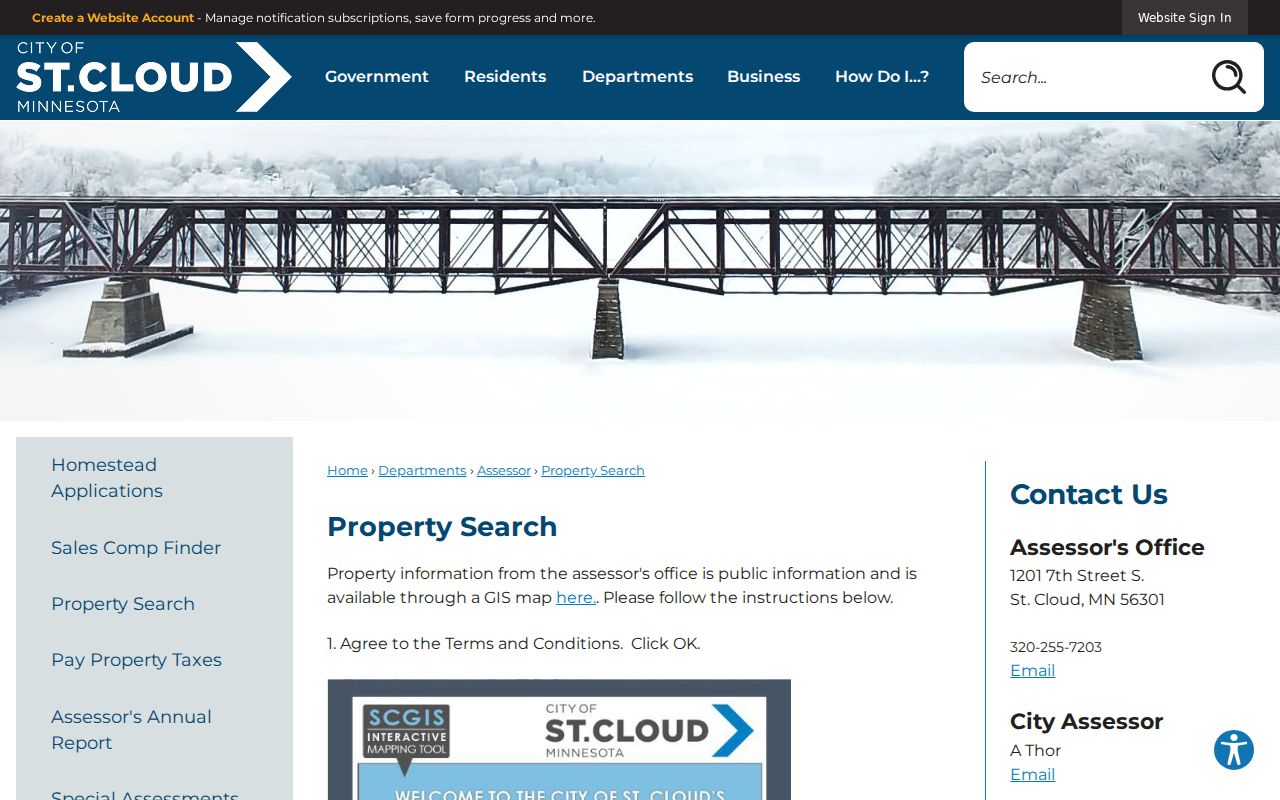
The city map can clarify a physical parcel location when a St. Cloud postal label and city boundary are not assumed to match.
The Stearns Property Information gateway is another address, owner, or parcel route. The research documents county tax and property pages as parcel, property-address, and map searches. It does not document a ZIP-wide filter, and the live advanced-search field set was flagged for confirmation rather than assumed.
The county property gateway is shown here as an address-and-parcel research route.
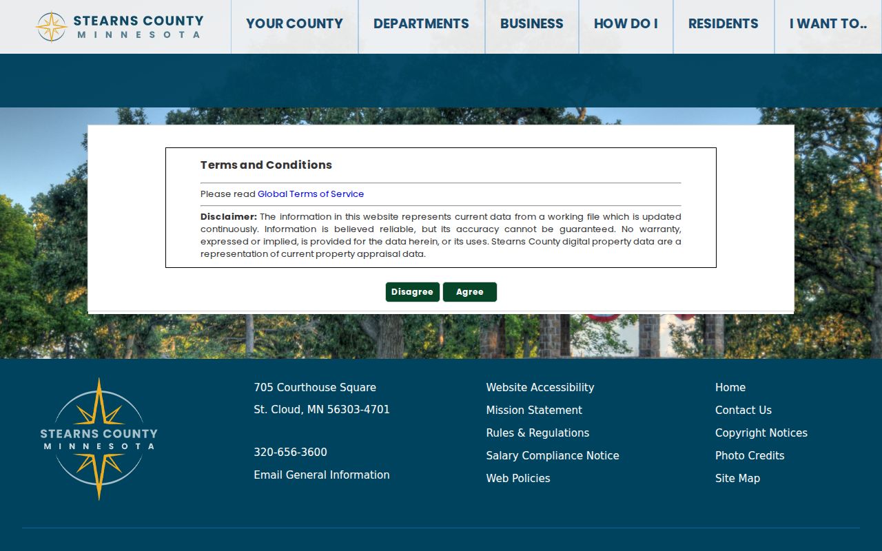
Checking a St. Cloud ZIP against an exact property address avoids treating an undocumented filter as a verified way to search a whole postal area.
St. Cloud Mailing and Situs ZIPs
Different address fields answer different questions. A situs address is the physical parcel address. A mailing address is where tax or owner correspondence goes, and it can be elsewhere. A legal description is the lot, block, subdivision, or other deed-and-plat key. A county GIS resident or property label is not guaranteed to be postal-valid. USPS standardized address and ZIP information are a separate delivery check.
Stearns County’s GIS mailing-label tool makes the owner and resident distinction explicit. Owner returns the property owner’s name and mailing address, which may be outside the parcel ZIP or even outside Minnesota. Resident returns the property address, which may not be a valid mailing address. Both can provide the broadest parcel lead, but they do not prove current household membership or postal delivery.
- ZIP
- A postal delivery code associated with an address or postal area, not a municipal boundary.
- ZIP+4
- An added four-digit delivery detail used with a five-digit ZIP to refine routing for a more specific address range or destination.
- PO Box ZIP
- A postal code used for post-office boxes and not necessarily for street delivery in the surrounding area.
- Unique ZIP
- A code assigned for a particular organization or use. A listed special code needs USPS verification before its function is described.
- Carrier route
- A postal delivery route within a ZIP area. It is not a city-limit map or a resident directory.
St. Cloud ZIP City Limits
St. Cloud city lines, the St. Cloud postal name, and nearby metro communities overlap without being the same geography. Sauk Rapids, Waite Park, Sartell, St. Augusta, and St. Joseph can share postal or area context while remaining distinct municipalities. Use the exact address in USPS and the parcel map rather than inferring a municipal location from a ZIP label.
Historical geography adds another layer. Upper Town or Acadia, Middle Town or St. Cloud, and Lower Town or St. Cloud City were separate early settlements united in 1856. Middle Town was platted in 1854. Old maps also call Washington Avenue South “5th Avenue South” and Richmond Avenue “6th Avenue North” in the 1869 context. These are useful crosswalk terms when an older address does not fit a modern street string.
For a current street or parcel trail after the ZIP is settled, use the St. Cloud street directory route. It handles address-keyed county and city records rather than treating a ZIP as a complete address.
St. Cloud ZIP Data Limits
Minnesota vital standard data reports can be requested by county or ZIP for events registered since January 1, 2011, for up to 12 months per report. The reported fee is $15 per report. That product is aggregate or statistical data, not a named resident search. It can describe an area for a period, but it does not establish who lives at a St. Cloud address.
County GIS layers provide parcels and map context, while property reports can provide owner and value information. Neither one is a postal authority. The county notes that an owner mailing ZIP can differ from the situs ZIP and that a resident or property address may not be postal-valid. Keep USPS, municipal location, owner mailing, and parcel address as separate facts.
St. Cloud ZIP Changes
No official source located a St. Cloud five-digit ZIP realignment or split year. The 2025 USPS Postal Bulletin identified 562 and 563 processing-center labels, but it did not document a St. Cloud boundary change. A date should not be attached to a ZIP change without a source that actually identifies the five-digit boundary and effective period.
When an older record has a St. Cloud postal label that seems unfamiliar, confirm the old street name, modern address, parcel location, and USPS result in that order. Then check the relevant municipal or county source. This method is slower than assuming a ZIP boundary stayed fixed, but it keeps the postal history, city geography, and property record from being conflated.
Note: A verified address can support a targeted records request, while a ZIP alone remains only a starting point for local research.